Wildfire hazard data
you can trust
Canadian wildfire hazard data at 30-metre resolution, updated annually to reflect changing vegetation, climate, and land use. Built on peer-reviewed science. Trusted by insurers, utilities, and land managers across Canada. Powered by ApexRMS.
 30-Metre Resolution
  Built on Peer-Reviewed Science
  Annual Updates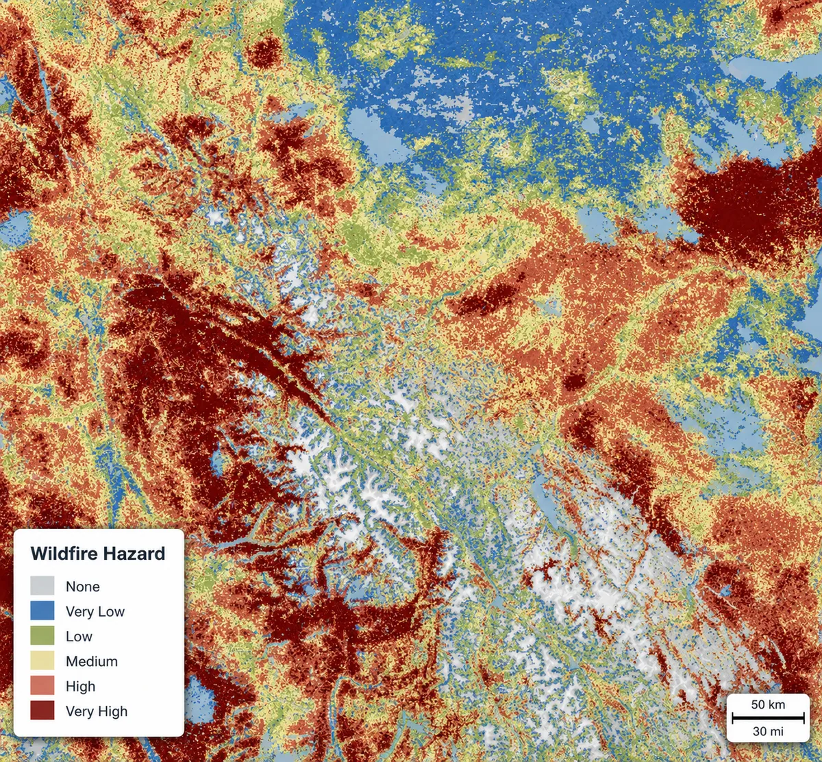
Why do we need trusted wildfire hazard data?
Your wildfire hazard data should keep pace with the risk landscape.
Fire Hazard Canada: Built for Decisions
Fire Hazard Canada delivers continuously-updated wildfire risk intelligence at 30-metre resolution across Canada, built on peer-reviewed science. From utility corridors to insurance portfolios, make confident decisions with data you can trust.
Science-Based Methodology
Built on published, peer-reviewed science with transparent, reproducible methods. Defensible data you can explain to stakeholders.
30-Metre Resolution
Property-level precision for accurate risk assessment and targeted action. Identify hazard associated with individual properties, not broad regional averages.
Annual Updates
Reflects latest vegetation, climate, and land use changes. Your data stays current as conditions evolve.

Flexible Delivery
Access via web browser, GeoTIFF download, or API integration. Fits your existing workflows and systems.
Why It's Reliable
-

Process-based, not an AI proxy
A physical simulation of how fire actually spreads, not a statistical or machine-learning black box.
-

Integrates fuels, terrain, ignitions, and weather
Every hazard estimate accounts for fuel loads, topography, historical ignition patterns, and climate and weather conditions.
-

Co-developed with NRCan
Built and refined in conjunction with Natural Resources Canada. Approach validated over 20+ years across 20+ peer-reviewed publications.
Three Ways to Work With Us
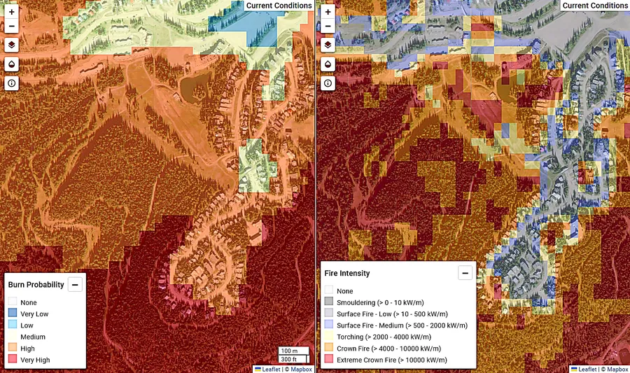
Detailed Model Outputs
Bring model results into your own systems and workflows.
-
 30-metre wildfire hazard surface
 - maps of burn probability, fire intensity, rate of spread
- Full stochastic event catalog
"What-If" Scenarios
Stress-test exposure under forward-looking conditions before you commit.
- Future climate change
- Fuel treatments and other mitigations
- Reproducible, defensible model runs
Approved Partner Solutions
Solution partners refine the same hazard baseline into decision-ready scores and tools for your industry.
- Property-level scores, reports, and more
- Delivered inside your existing workflow
- No GIS team required
Solutions for Your Industry
Insurance & Underwriting
Price risk with precision, not proxies
Coarse-resolution wildfire models miss property-level variation, leading to mispriced policies and unexpected loss ratios. Fire Hazard Canada delivers that granularity two ways — use the model outputs directly, or take a ready-made score built from them.
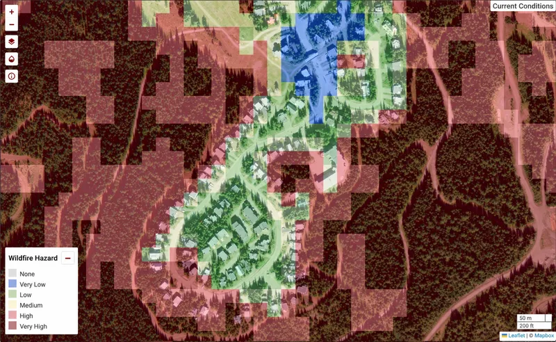
 Direct from us
 Insurers and reinsurers work with the model outputs directly: the final hazard surface, raw model outputs, full event catalog, and future modelled scenarios.
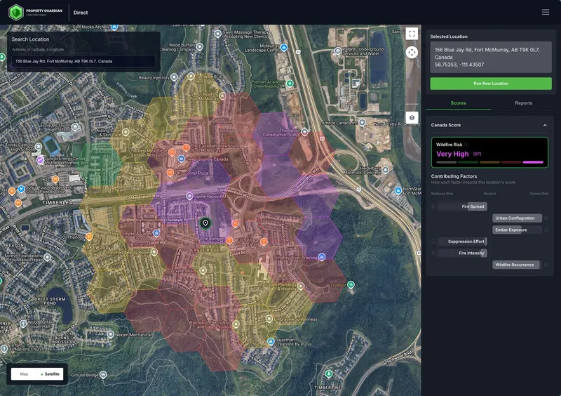
 Powered by Property Guardian
 Our solution partner Property Guardian refines the same hazard baseline into the Canadian Wildfire Risk Score + Insights — a single 0-to-100 underwriting score.
Utilities & Critical Infrastructure
Protect assets and infrastructure before the threat arrives
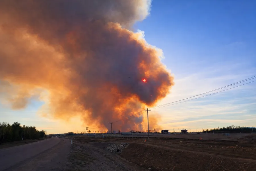
Wildfire risk from vegetation contact threatens grid reliability, triggers Public Safety Power Shutoff (PSPS) events, and creates regulatory exposure. Pipeline networks, telecom facilities, and transportation corridors face the same growing threat. Fire Hazard Canada enables proactive risk management and defensible compliance documentation across your entire asset footprint.
- Transmission corridor risk assessment
- Vegetation management prioritization
- PSPS planning and documentation
- Pipeline and right-of-way risk assessment
- Emergency response and maintenance prioritization
Forestry & Land Management
Protect timber value and plan with confidence
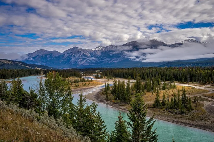
Wildfires threaten timber investments, carbon credits, and decades of forest management. Fire Hazard Canada enables prioritized resource allocation, strategic harvest planning, and informed prescribed burn decisions.
- Timber asset protection planning
- Prescribed burn prioritization
- Reforestation site selection
- Carbon credit risk assessment
- Fuel treatment planning
Government & Community Planning
Plan with confidence for the communities and lands you steward
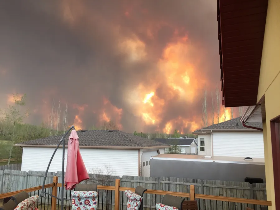
Municipal, provincial, and Indigenous governments need credible, high-resolution wildfire risk data to inform zoning, forest management, conservation, and community safety planning. Fire Hazard Canada provides the science-based foundation for defensible decisions at every level of government.
- Zoning and land-use planning in wildfire-prone areas
- Community Wildfire Protection Plan (CWPP) development
- Forest management and conservation prioritization
- Indigenous territory and cultural site protection planning
- Emergency preparedness and evacuation planning
Wildfire Hazard Extent
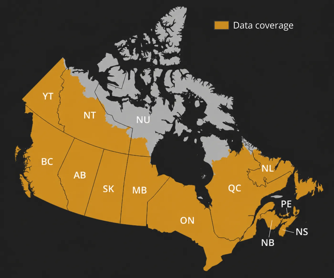
Our data covers virtually all of Canada's wildfire-prone landscapes: every province, Yukon Territory, and Northwest Territories.
-
Spans the entire Canadian boreal forest, the world's largest intact forest ecosystem, covering ~552 million hectares
-
Covers all major wildfire-prone ecozones: Boreal Shield, Montane Cordillera, Prairies, Taiga Plains, and Atlantic Maritime
-
Includes virtually all of Canada's ~347 million hectares of forest, 9% of the world's total forest cover
How It Works

Choose Your Coverage
Select your geographic area of interest from our Canada coverage map

Access Your Data
Access via web browser, download GeoTIFF files, or integrate via API

Act on Insights
Prioritize maintenance, underwrite accurately, or plan fuel treatments
Data Delivery Options

Web Browser
Explore data interactively in any browser without software installation

GeoTIFF Download
Download standard files for use in ArcGIS, QGIS, or custom applications

REST API
Direct integration into underwriting systems, dashboards, or workflows
Fire Hazard Canada: Methodology and Validation Report
A technical deep-dive into how Fire Hazard Canada is built: modelling inputs, validation against observed fire behavior, and the scientific patterns behind our 30-metre resolution wildfire hazard layers. Sign up to be notified the moment it's published.
Frequently Asked Questions
Getting Started
How quickly can we get access to the data?
Most customers receive access within 5 business days of completing an agreement. Enterprise integrations may require additional setup time.
Can I evaluate the data before purchasing?
Yes. We offer sample data downloads and demos to help you evaluate fit. Contact us to request access.
What geographic coverage is available?
Fire Hazard Canada currently covers all of B.C. and Alberta. The rest of Canada will be released in October, 2026.
Technical
What is the data resolution?
Fire Hazard Canada is provided at 30-metre resolution, enabling property-level wildfire risk assessment.
How often is the data updated?
Data is updated annually to reflect changes in vegetation, climate patterns, and land use.
What formats are available?
Data is available via web browser, GeoTIFF download, and REST API. Enterprise customers can request custom formats.
How does Fire Hazard Canada integrate with GIS software?
GeoTIFF files work natively with all major GIS platforms including ArcGIS, QGIS, and Google Earth Engine.
Methodology
How is wildfire hazard calculated?
Our methodology combines vegetation type, topography, climate data, and historical fire patterns. It is built on peer-reviewed science and NRCan's established fire modelling methods (Burn-P3+).
Is the methodology validated?
Yes. Our methods are built on peer-reviewed scientific literature and NRCan's validated fire modelling framework. We also conduct ongoing validation against observed fire behavior.
Business
What are the licensing terms?
Licensing is typically annual and based on coverage area and delivery method. Enterprise agreements offer custom terms.
Can multiple team members access the data?
Yes. All plans support multiple users within your organization. Enterprise plans offer unlimited seats.
Wildfire Risk Isn't Waiting.
Neither Should You.
Get high-resolution, current, and credible wildfire hazard data today.